Capturing the earth's surface and its elements on a map or
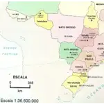
Capturing the earth's surface and its elements on a map or globe requires a reduction of reality. This reduction is expressed by the scale. Both numeric scales (represented by fractions) and graphic scales convey the same information to the user. However, the graphical scale has an advantage in representing the distance on the map by means of a line segment, allowing enlargements or reductions of the map to preserve the proportion between the distances on the map and in reality.
Did you know?
