Graphic Scale: represents, through a straight line segment
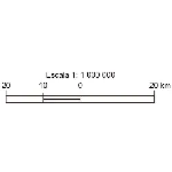
Graphic Scale: represents, through a straight line segment, the relationship between representation and reality.
It is represented by a straight line segment, divided into equal parts. Each of these divisions corresponds between actual distances and distances on the map. This scale allows quick reading of real distance values.
Advantages: We can enlarge or reduce the size of the map always maintaining the correct scale.
Did you know??
