 ≡
≡@Daniel Carvalho - Viseu, Portugal
🧠 Educational content • Interactive quizzes
Landscapes and Maps >>
Aerial Photography
Aerial Photography: It constitutes a privileged method for remote observation of the terrain, standing out as one of the most economically viable sources for cartographic updating, the production of orthophotomaps and the creation of three-dimensional models of the territory
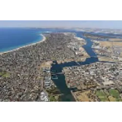
However, due to the notable degree of distortion present in aerial photographs, it is essential to correct them before using them. These images are captured from aircraft and provide detailed views of the Earth's surface.